
BOZEMAN, Mont., April 7, 2015—Mountain locations which provide water in the form of snowmelt during the spring haven’t seen normal snowfall in the last two months, and during March Montana experienced declines of 11 to 35 percent, according to snowpack data from the USDA Natural Resources Conservation Service (NRCS).
Most of the declines can be attributed to the lack of normal snowfall during the last month, but some of it is due to the well above average temperatures, which caused snowmelt at low and some mid elevations. All basins in the state of Montana are now below normal for April 1, with statewide snowpack currently 68 percent of normal.
“Across the West, it has been a disappointing snow year, and this is the first month that Montana has seen all of its basins drop into the below normal category,” said Lucas Zukiewicz, NRCS water supply specialist for Montana. “Fortunately, we received excellent snowfall early in the year, or we could have seen conditions play out in our state as our neighbors to the west have where a snow drought has been occurring all year.”
Some basins in the northern half of the state are well below normal in terms of water year snowfall; instead that area has received the bulk of its moisture this winter in the form of rain. “These basins, which are well below in terms of snowpack on April 1st, are near to above average when it comes to water year-to-date precipitation beginning October 1st,” Zukiewicz said.
47 measurement locations (of 90 SNOTEL and 90 snowcourses) set new period of record low snow water equivalent values for April 1. Many of these sites are lower in elevation and the reduction of snowcover at these elevations has had an impact on the basin percentages.
[EasyDNNGallery|1630|Width|700|Height|700|position||resizecrop|False|lightbox|False|title|False|description|False|redirection|False|LinkText||]
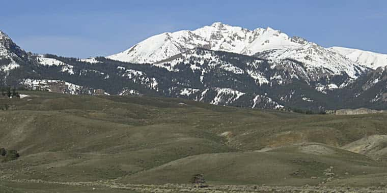
The snowpack east of the Divide has seen the biggest decrease during the month, where well below normal snow and precipitation fell during March. This combined with above average temperatures has caused declines of 18 to 35 percent from March 1 to April 1. All but two of these basins continue to have near normal precipitation for the water year (Jefferson and Madison River basins).
The good news, Zukiewicz said, is the higher elevation snowpacks, which received an abundance of moisture and were well above normal early this year, continue to be near to slightly below normal and have been spared from the bulk of the melt so far. “Higher elevations help to supply water later in the runoff season as they are typically deeper and melt out over a longer time period,” he said.
Zukiewicz said the snowpack across the state typically peaks in April to May depending on the basin, so the next month or two will be make or break for the state water supply. “The saying goes ‘if you don’t like the weather in Montana, just wait a day,’ well…we’ve been waiting.”
Streamflow Forecasts
Streamflow forecasts for the April-July time period reflect the drops in snowpack percentages since March 1. East of the Divide in the Missouri River basin, the spring flows are the lowest statewide and should be well below average this spring and summer. A close eye will be kept on spring and summer precipitation in these basins as it will likely have a big impact on the water we have in the rivers this year. Although basins in the northwest are well below normal for snowpack, streamflows forecasts have stayed higher due to the abundance of precipitation in the basins.
“After an excellent water year last year we are looking at a different story this summer, perhaps only 45 to 80 percent of what we received last year, Zukiewicz said. “The silver lining is reservoir levels were kept at the winter maximum in many locations and excellent carryover should help to keep some water in the rivers for irrigators and recreationists this spring and summer.”
Some river basins are forecasted to be well below average for the April-July time period due to the lack of snowfall and water year precipitation. For detailed river basin information and forecasts for this year, Montanans should consult the April 1 Water Supply Outlook Report.
Below are the averaged river basin streamflow forecasts for the period April 1 through July 31. THESE FORECASTS ASSUME NEAR NORMAL MOISTURE AND RUNOFF CONDITIONS APRIL THROUGH JULY.
For detailed information on individual basin conditions refer to the April 1 Water Supply Outlook Report.
[EasyDNNGallery|1631|Width|700|Height|700|position||resizecrop|False|lightbox|False|title|False|description|False|redirection|False|LinkText||]
Source: Montana NRCS


