
by Keith Ridler, The Associated Press
BOISE, Idaho (AP) — Scientists have deployed drones over western Idaho to map a little-known landscape as part of an effort to reduce wildfire risks and protect sage grouse and other wildlife across the West.
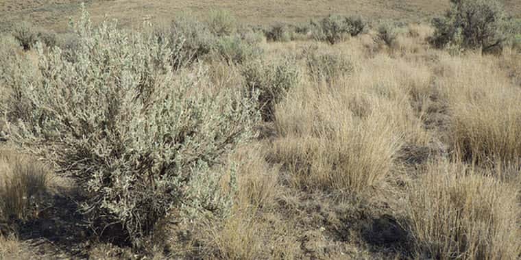
They say they have to learn more about what grows in the region so that when charred areas are restored, land managers don’t plant a type of sagebrush that sage grouse won’t eat.
The football-sized bird found in 11 states is being considered for federal protections under the Endangered Species Act.
“The lack of maps is a huge, critical problem for conserving sagebrush and any species — like sage grouse — that depend on it,” Matt Germino, a U.S. Geological Survey ecologist, said.
“We have probably replanted the wrong type of sage brush to some habitats,” he said.
A key part of the Interior Department’s new wildfire strategy involves replacing native plants after giant blazes, which have been an increasing problem in rangeland in many Western states over the last decade. Such efforts would reduce the likelihood of invasive plants, which often burn more easily, from overrunning scorched areas.
But without maps, land managers can’t be sure which sagebrush subspecies to plant.
Scientists want to use drones to identify and map the range of three subspecies of big sagebrush. The most abundant is called Wyoming big sagebrush. Basin big sagebrush is the most drought-tolerant. Mountain big sagebrush, meanwhile, is typically found at higher elevations.
CLICK HERE to read the full article.
Source: Associated Press
